Brazil GPM Ground Validation
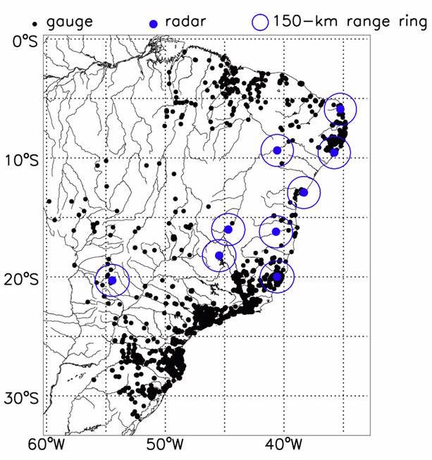
GPM Ground Validation Data in Brazil
| ID |
Location |
Latitude |
Longitude |
| T1 | Natal | -5.904444 | -35.2539543 |
| TM1 | Tres Marias | -18.207222 | -45.460556 |
| SV1 | Salvador | -12.902500 | -38.326667 |
| ST1 | Santa Teresa | -19.988775 | -40.579444 |
| AL1 | Almenara | -16.201944 | -40.674167 |
| MC1 | Maceio | -9.551389 | -35.770833 |
| JG1 | Jaraguari | -20.291492 | -54.4657734 |
| SF1 | Sao Francisco | -16.017350 | -44.695250 |
| PE1 | Petrolina | -9.367220 | -40.572770 |
|